
Menlo Park, New Jersey
Now and Then
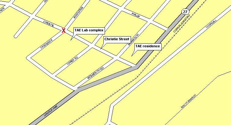
A look at the location of Thomas Edison's laboratory
This series of pages looks at Menlo Park in the year 2000. Compare the area today with the old images from Edison's time. Maps and photos illustrate the changes that have taken place in the time since Edison invented a whole new world.
Middlesex Avenue in Edison's time was on the map, but it wasn't much of a street in reality.
Here is what that area looks like today:
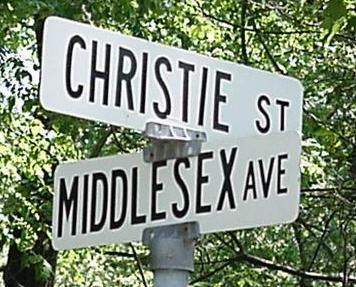
The view looking north on Middlesex from Christie Street:

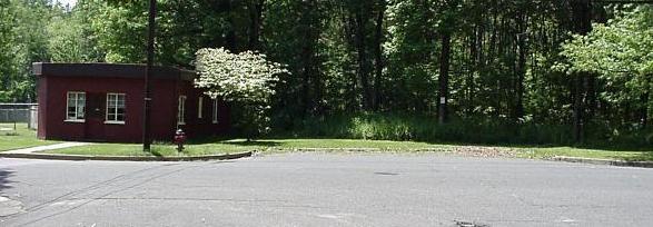
The view looking south on Middlesex from Christie street, the Museum on the left. Maps show a street, but the trees stand tall and in the way.
The view down Christie Street, headed to the Lincoln Hwy. Edison would have walked this way to go home for the night.

Map Next pagePrevious PageThomas Edison indexJ Halpin CPA page