Home > Metuchen Edison History > Thomas Edison in Menlo Park Index > Map Locations
Home > Metuchen Edison History >
Thomas Edison in Menlo Park Index > Map Locations
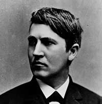
Thomas Alva Edison
In Menlo Park, NJ
Here is a map of Menlo Park (today), with approximate locations for houses, buildings and other landmarks from the late 1870's. Thornall Street and Route 27 (the Lincoln Highway) have been re-aligned since Edison's time, and some street names have changed.
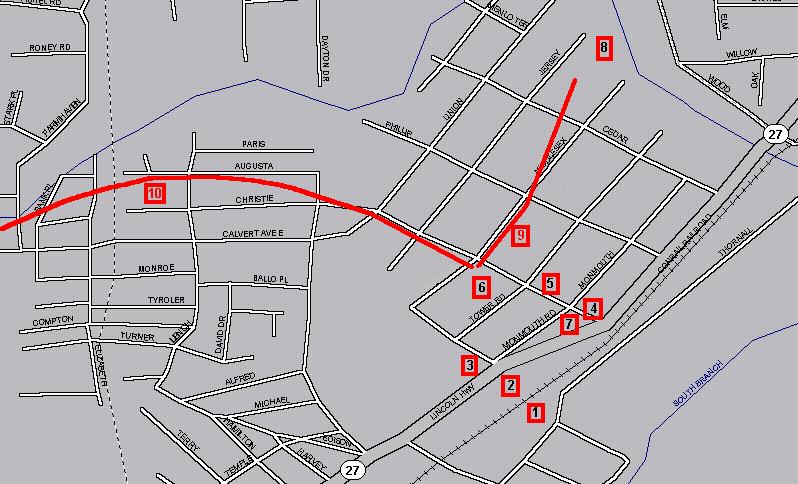
#1 is the approximate location of the railroad station.
#2 is where the steps led up from the tracks to the boardwalk; the Lighthouse Tavern is also in this area.
#3 is the home of Francis Upton (corner of Monmouth and Frederick).
#4 is the home of Thomas Edison (site of a commemorative tablet).
#5 is the location of Sarah Jordan's boarding house, and right next door (at the corner of Christie and Woodbridge/Tower) is the home of Mr. Dean.
#6 is the location of the laboratory grounds: library office/ laboratory/ machine shop/ carbon shed.
#7 is the home of Mr. Batchelor and Mr. Kruesi.
#8 is the approximate location of the Mine Gully.
#9 is the approximate route of the first experimental electric railroad.
#10 is the approximate route of the second experimental electric railroad, which continued on past Dark Lane (Grove Avenue) and ended near Pumptown (on the grounds of the Metuchen Country Club). Total distance was in excess of 8,000 feet.
The Lamp Factory was located on the other side of the tracks, somewhere near the bottom of Cedar.
Return to the Thomas A Edison in Menlo Park index
Return to The Metuchen Edison History Features index
Last updated by Jim Halpin on 7/1/99.